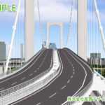
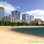
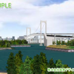
This technology allows you to freely move in the VR space by real-time operation. You can see bridges, buildings, and structures from any angles you like.
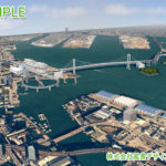
Tokyo Harbor VR
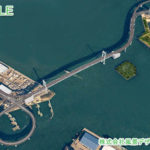
This is the 3DVRCG data showing Tokyo Harbor area.
You can freely move in the VR space by real-time operation and see bridges, buildings, and structures from any angles you like.
SLDI proposes usage methods according to your business, such as examining the internal and external landscapes of bridges, examining building designs, and making presentations at resident briefings.
A 6km square around Tokyo Harbor centered on the Rainbow Bridge is reproduced in this VR. This map uses the numerical map 2500 (spatial data basis), the numerical map 50m mesh (elevation) issued by the Geographical Survey Institute, and the aerial photographs taken by the Geospatial Information Authority of Japan. (Approval number: Hei 16 Sou-Shi, No. 198)
Approximate Cost to Create This Data: 5 million yen, Approximate Delivery Time: 3 months
Housing Complex Planting Plan VR
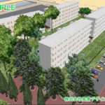
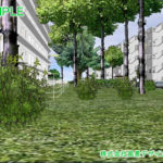
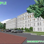
This sample image shows the usage of VR to evaluate planting plan to prune trees appropriately to improve safety by reducing blind spots and to compare the darkness by plants in a 40-year-old housing complex.
By comparing before and after pruning, you can visually consider a planting plan that does not destroy the green landscape of the housing complex.
It is possible to show the scenery from each house in real time according to the request of each resident at the resident briefing session.
In addition, each tree can be moved or deleted on the spot, and you can consider a planting plan with the residents.
Approximate Cost to Create This Data: 500,000 yen, Approximate Delivery Time: 2 weeks
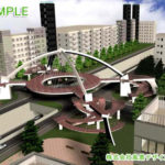
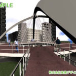
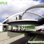
Symbolic Pedestrian Bridge VR
The well-designed pedestrian bridge is a landmark of the area due to its structural beauty and unusual shape, but it also has a great impact on the surrounding landscape.
In addition, it is difficult to grasp the appearance of the shape of a structure only by drawing.
By arranging a pedestrian bridge with a complicated shape in the VR space, it becomes possible to visually examine whether the pedestrian bridge and the scenery of the surrounding area are in harmony, and whether safety can be secured from the driver’s point of view.
Approximate Cost to Create This Data: 700,000 yen, Approximate Delivery Time: Approximately 2 weeks
